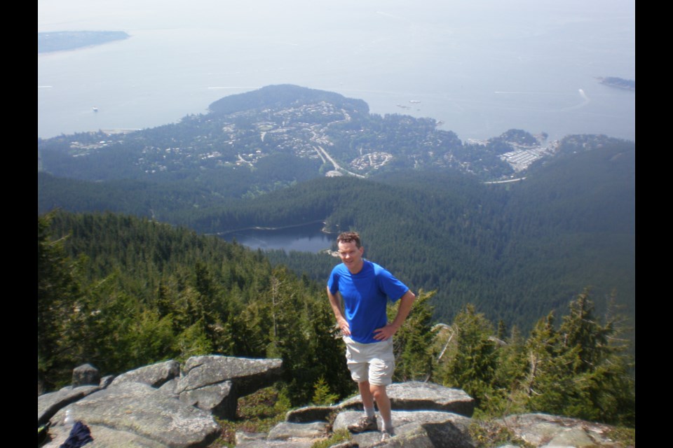
A little mud on your boots, and plenty of sweating in the first 30-40 minutes of this hike will be worth it for the chance to stand on top of two mountain peaks, gaze at (or swim in) gorgeous alpine lakes, and eventually reach the North Shore’s most spectacular viewpoint—Eagle Bluff.
But for many people the hardest part of this hike will be packing up and leaving the bluffs for the return home.
A few words of caution: this is a backcountry alpine hike--strenuous and steep in many places, so be prepared with proper clothing, sturdy shoes or boots (boots recommended), food and extra water. Remember: weather conditions can change quickly in the alpine. Sunscreen and bug repellant are also handy.
Like Mt. Seymour, this is a popular snowshoeing trek from November to May, and in many ways is even more enjoyable in winter/spring. (Hint: less bugs)
Bring the map provided with this article (also available online and using the Layar app). A new “official” Cypress area hiking map will be available starting August 10th, and is long overdue for such a popular hiking area. But my rule of thumb when doing this hike is always: “When in doubt, follow the Baden Powell trail markers.”
You’ll need a vehicle, as there is no transit up Cypress Bowl Road. Park as close to the ski resort buildings as you can. The actual trailhead is well marked on the north side of the base of the Black Mountain (Eagle) ski lift.
The Baden Powell trail quickly turns left and heads up switchbacks parallel to the ski run. While you’re sweating up a storm (and drinking plenty of water), remind yourself how great I’ve told you it is at the top. Eventually the trail levels out as you pass a junction and stay right until you reach tranquil Cabin Lake. Some people bring a swimsuit along for a quick dip to cool off.
Black Mountain actually has two peaks—south and north—each accessible via short but steep hikes and each with a much different view. The north peak has a perfect look at The Lions, while the south peak overlooks the Cypress Bowl to Mt. Strachan and Hollyburn Peak to the east, along with Bowen Island and the Sunshine Coast to the west. But better views are still to come!
Heading south, the descent from the peak quickly re-enters the dense forest and the trail (with occasional boardwalks through muddier, marshy sections) offers glimpses of small alpine lakes before re-joining the Baden Powell Trail at the tip of Owen Lake. Turn right at the junction and follow the BP trail markers as they hug the lake’s edge. A few minutes later, you pass through the Cougar Lakes.
From here, it’s “follow the BP markers” over the rolling forest plateau as the anticipation builds for the final destination. There’s a tiny opening in the trees which gives a hint of the views, then you suddenly burst out into the open air of the bluffs.
I dare you to not be spellbound by the vista below. From west to east, Mt. Baker, Metro Vancouver, Point Roberts, Horseshoe Bay, Bowen Island, Vancouver Island, the Sunshine Coast and Howe Sound spread out as you enjoy lunch on your rocky perch. Keep your eyes peeled for aggressive ravens and grey jays trying to steal your food!
For the reluctant return trip, stay on the Baden Powell all the way, visiting Theagill and Sam Lakes, then skirting around the south peak. Turn right at the junction with the trail to the knee-knackering switchbacks down to the parking lot.
Yet another satisfying part of this hike is looking back when it’s long over. When you return to Vancouver, take a look at the western end of the North Shore Mountains. See that extremely steep slope reaching the point where it joins a plateau? That’s where you had your lunch!


