
Environment Canada has issued a wind warning for Metro Vancouver as a strong Pacific storm brings powerful wind to the south coast.
Yesterday, the department issued a rain warning, calling for up to a whopping 90 millimetres of rainfall overnight. Now, the forecast states that strong winds that may cause damage are expected or occurring.
Strong winds are expected to move across southern sections of Howe Sound including Bowen Island, and to West Vancouver near the Strait of Georgia late this afternoon and early this evening. Later this afternoon, strong southeasterly winds of 70 km/h gusting up to 90 km/h will develop.
Wind warning in effect for:
- Metro Vancouver - central including the Vancouver, Burnaby and New Westminster
- Metro Vancouver - southeast including Surrey and Langley
- Metro Vancouver - southwest including Richmond and Delta
- Metro Vancouver - North Shore including West Vancouver and North Vancouver
The winds will ease late this evening, but will remain brisk into Saturday morning.
As a result of the powerful winds, the warning notes that loose objects may be tossed by the wind and cause injury or damage. In addition, high winds may toss loose objects or cause tree branches to break.
To report severe weather, send an email to BCstorm@canada.ca or tweet reports using #BCStorm.
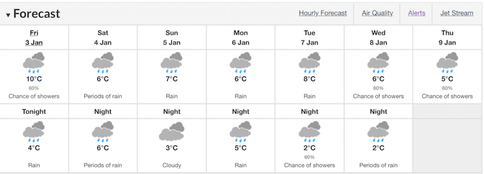
Metro Vancouver Weather Forecast
B.C. Winter Forecast
Back in September, The Weather Network predicted that British Columbia would have a milder winter, but that December was a “wild card.”
Since then, the winter forecast has been updated to include the most recent prediction, which calls for milder temperatures along the B.C. coast and across much of Northern B.C. While northeastern B.C. to the southern interior will see near normal temperatures.
While the north coast region is, “expected to see above average rainfall and alpine snow,” the south coast region is expected to be drier than normal. With this in mind, the forecast adds that this dry pattern may break at times during the season. During these breaks, the Lower Mainland could have the “potential to see several weeks’ worth of precipitation in just five to 10 days.”
Read the original article here.