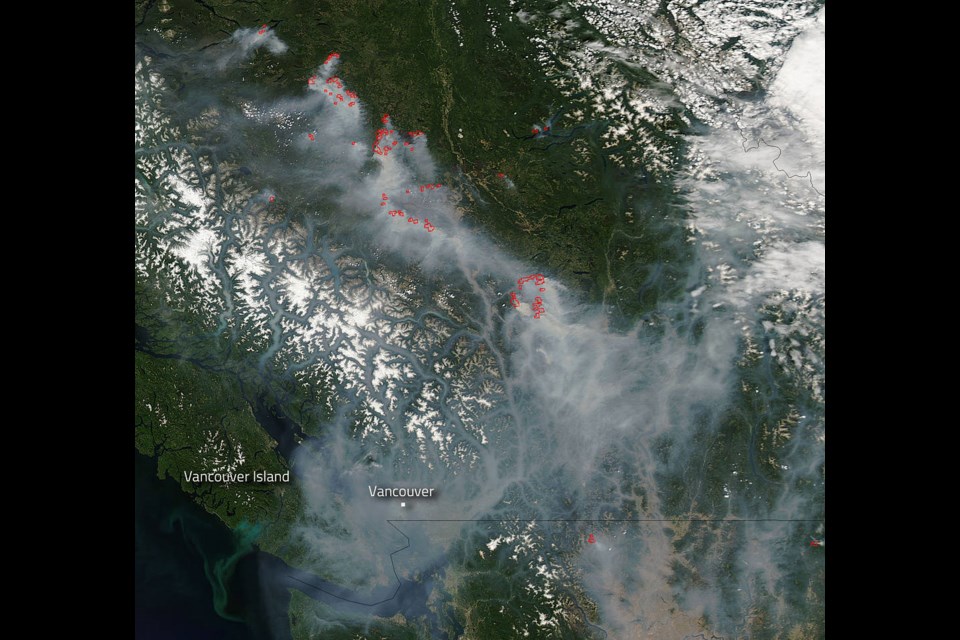
NASA has released photos showing smoke from B.C. wildfires blanketing southern B.C. and Washington State.
The photos were taken from space Aug. 1 and 2.
But you don’t need to be in space to see just how much the smoke from those interior wildfires has affected air quality and visibility in the Fraser Valley, Lower Mainland and Metro Vancouver — just look out the window.
The dangerous air pollution levels and heat wave expected to last through Friday has led to warnings from Environment Canada. According to Environment Canada, a massive ridge of high pressure will remain over southern B.C. Daytime maximum temperatures are expected to soar into the mid-thirties through Friday for communities in the Fraser Valley, Howe Sound, Whistler and Inland Vancouver Island. Temperatures will be several degrees cooler near the straits of Georgia and Juan de Fuca. The heat combined with the lack of rainfall will maintain high to extreme fire danger ratings across much of southern B.C.
Heat-related illnesses are more likely during prolonged periods of hot weather putting everyone is at risk. Those most vulnerable to high temperatures include young children, pregnant women, the elderly, those working or exercising in the heat, persons with chronic illnesses, people living alone in un-air-conditioned homes, and the homeless.
The Air Quality Index has been high all week. For current information on air quality across the province, visit weather.gc.ca.
@sthomas10