
So let’s get this out of the way: Dog Mountain isn’t really a mountain. It’s a rocky outcrop that’s part of Mt. Seymour. Dinkey Peak is kinda dinky, especially compared to the Mt. Seymour peaks but it’s still wonderful. And Mt. Seymour has three peaks, each one a little better than the one before.
The Mt. Seymour area has numerous great hikes for all ages and fitness levels that offer some of the greatest views the North Shore. You will need a vehicle, as there is no public transit up Mt. Seymour Road. This area is also one of the most popular local snowshoeing destinations, and on some sunny winter days, the Dog Mountain trail resembles Highway 1 in rush hour.
For the majority of people (and most families), the 2.2 kilometre Dog Mountain trail is the preferred choice. It has minimal elevation gain to a spectacular viewpoint — spanning from Mount Baker to Vancouver Island. But don’t assume you won’t build up a sweat. The trail is rolling, with numerous dips and rises, so the accumulated elevation gain is probably closer to 100 metres.
The trail can also be very muddy and slippery early in the summer as snow melts. Can you still see any patches of snow hidden in the shadows?
Another feature of the Dog Mountain trail is the stop at serene First Lake, at approximately the half-way point. Small bridges and boardwalks around the lake area keep your feet out of the muddiest sections and also protect the fragile sub-alpine plant life and related ecosystems.
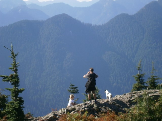
I always enjoy the last 30 metresof the trail, hearing the “oohs and ahhs” of people as they break out of the forest, reach the rocky clearing and get their first glimpse of the Lower Mainland stretching out below them. The outcrop will likely be busy with other hikers, so spread out and find your own spot to have a lunch break. DO NOT venture too close to the edge of the cliffs.
Another word of warning: you are also usually sharing this spot with some ravenous ravens that can be quite aggressive. Don’t leave any food unguarded. I’ve witnessed people watch their entire lunch bag fly away in the claws of a raven.
Eventually you reluctantly have to leave, retracing your steps to First Lake. If you’re not in a rush, turn left at the signpost indicating the trail to “Dinkey Peak” and after a winding uphill trek, turn right at a clearly marked trail. A few hundred metres takes you to a small wooden staircase which climbs the ‘peak.’ The parking lot is just below you, but also prime views of Mount Baker, Golden Ears and beyond. Not dinky at all!
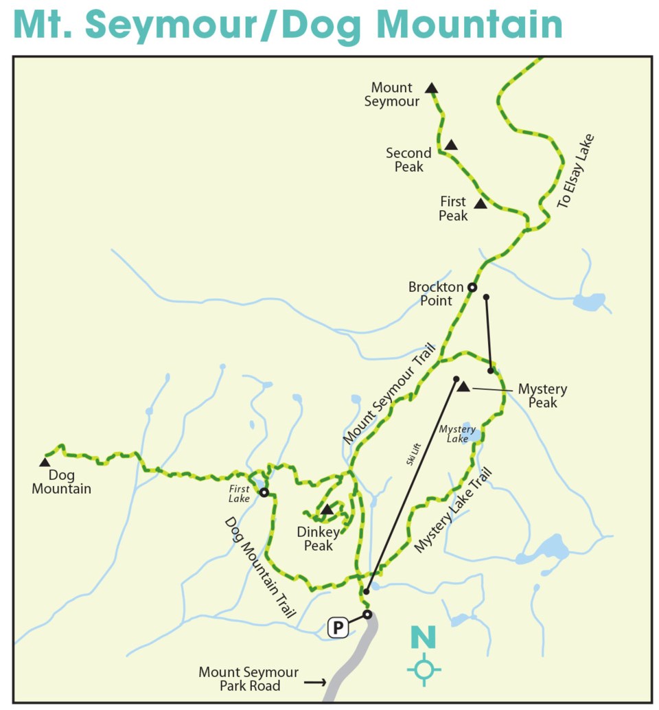
For those fit enough and properly prepared for a back-country alpine hike, the eight kilometre (return) hike to Mt. Seymour’s First Peak is even more spectacular. But another word of warning — be prepared! Weather conditions can change rapidly in the alpine, and the trail is steep and slippery in numerous sections. Proper clothing, footwear, sunscreen, food and extra water are recommended. As well as common sense!
The first part of the trail runs parallel to the ski lift, passing small lakes before cresting at Brockton Point, where you get a post-card view of the peaks ahead. From here you navigate a series of picturesque gullies and alpine meadows before the final uphill push. Turn left at a signpost marking a junction with a trail to Elsay Lake (which goes right).
Each of the three peaks has a challenging upslope trail and might require a bit of “4-wheeling” (hands on the ground) at times. Be careful, but it’s all worth the effort to eventually stand on a mountain peak and absorb the 360 degree views. One peak might be enough (for most), or hike all three. (Update: A proposal has been made to rename Mt. Seymour’s second peak “Tim Jones Peak” in honour of the late leader of North Shore Rescue who passed away in January on these very trails. A small memorial has been created along the opening section of the Mt. Seymour Trail in tribute.)
Return by the same route, with the option of taking the Mystery Peak/Mystery Lake trail through the ski resort back to the parking lot.
Mike Hanafin is an avid back-country hiker who can see the forest and the trees.


